 vesseltracker.com
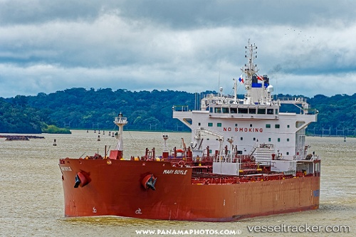
Mari Boyle
Current StatusWhere is the vessel?
Mari Boyle is currently in 128 nm E of Sydney Island, based on AIS data received less than 1h ago.
Latest AIS update:
Current position: 4.76487° S, 169.13242° W (128 nm E of Sydney Island)
Average speed (last 7 days): Loading…
Average speed (last 30 days): Loading…
Vessel profile: Mari Boyle is a Oil Products Tanker with dimensions 32m x 186m.
This page combines live AIS, route history, probable destination signals, nearby traffic, and port activity for practical vessel monitoring.
The current position of vessel Mari Boyle is -4.76487 lat / -169.13242 lng. Updated: 2026-05-15 20:01:27 UTCNearest reference points:
- 142 nm E of Enderbury Island
Details:
Live Vessel Mari Boyle Analytics (details, animations, etc.)
Recent AIS points (UTC):
2026-05-15 16:29:09 UTC · -4.97252, -168.47040 · SOG 11.8 kn · COG 286°2026-05-15 17:27:38 UTC · -4.91628, -168.65411 · SOG 11.8 kn · COG 285°
2026-05-15 19:44:40 UTC · -4.78172, -169.08116 · SOG 11.4 kn · COG 285°
2026-05-15 20:01:27 UTC · -4.76487, -169.13242 · SOG 11.5 kn · COG 285°