 vesseltracker.com
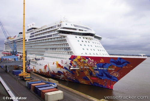
Genting Dream
Current StatusWhere is the vessel?
Genting Dream is currently in 12 nm SW of SUNGAI UDANG, based on AIS data received less than 1h ago.
Latest AIS update:
Current position: 2.07812° N, 102.01273° E (12 nm SW of SUNGAI UDANG)
Average speed (last 7 days): Loading…
Average speed (last 30 days): Loading…
Vessel profile: Genting Dream is a Cruise Ship with dimensions 44m x 334m.
This page combines live AIS, route history, probable destination signals, nearby traffic, and port activity for practical vessel monitoring.
The current position of vessel Genting Dream is 2.07812 lat / 102.01273 lng. Updated: 2026-04-30 20:00:05 UTCNearest reference points:
- 14 nm W of SUNGAI UDANG
- Near SUNGAI UDANG
- Near Malacca
Details:
Live Vessel Genting Dream Analytics (details, animations, etc.)
Recent AIS points (UTC):
2026-04-30 16:14:58 UTC · 2.63322, 101.27120 · SOG 14.3 kn · COG 116°2026-04-30 17:34:53 UTC · 2.45534, 101.53636 · SOG 14.5 kn · COG 128°
2026-04-30 19:32:29 UTC · 2.15338, 101.92128 · SOG 15.2 kn · COG 128°
2026-04-30 20:00:05 UTC · 2.07812, 102.01273 · SOG 15.7 kn · COG 129°