 vesseltracker.com
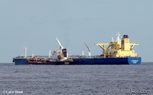
 SALAM
SALAM
Current Status
Where is the vessel?
SALAM is currently in 189 nm W of Tinaquillo, based on AIS data received less than 1h ago.
Latest AIS update:
Current position: 10.73254° N, 65.20455° E (189 nm W of Tinaquillo)
Average speed (last 7 days): Loading…
Average speed (last 30 days): Loading…
Vessel profile: SALAM is a Tanker with dimensions m x m.
This page combines live AIS, route history, probable destination signals, nearby traffic, and port activity for practical vessel monitoring.
The current position of vessel SALAM is 10.73254 lat / 65.20455 lng. Updated: 2026-05-14 00:06:52 UTCCurrently sailing under the flag of Saudi Arabia ![]()
Details:
Live Vessel SALAM Analytics (details, animations, etc.)
Recent AIS points (UTC):
2026-05-13 19:59:32 UTC · 10.91077, 64.41828 · SOG 13.1 kn · COG 101°2026-05-13 21:31:13 UTC · 10.82309, 64.74701 · SOG 13.3 kn · COG 105°
2026-05-13 22:23:53 UTC · 10.76936, 64.93524 · SOG 13 kn · COG 103°
2026-05-14 00:06:52 UTC · 10.73254, 65.20455 · SOG 2.3 kn · COG 25°