 vesseltracker.com
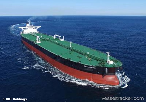
 DHT JAGUAR
Current Status
Where is the vessel?
DHT JAGUAR is currently in 114 nm SE of NISHINOOMOTE, based on AIS data received about 1h ago.
Latest AIS update:
Current position: 29.61700° N, 132.75961° E (114 nm SE of NISHINOOMOTE)
Average speed (last 7 days): Loading…
Average speed (last 30 days): Loading…
Vessel profile: DHT JAGUAR is a Tanker with dimensions m x m.
This page combines live AIS, route history, probable destination signals, nearby traffic, and port activity for practical vessel monitoring.
The current position of vessel DHT JAGUAR is 29.61700 lat / 132.75961 lng. Updated: 2026-05-18 06:19:18 UTCNearest reference points:
- 190 nm E of NISHINOOMOTE
- 77 nm S of Sukumowan
- 107 nm NE of Kitadaito Apt
Currently sailing under the flag of Marshall Islands ![]()
Details:
Live Vessel DHT JAGUAR Analytics (details, animations, etc.)
Recent AIS points (UTC):
2026-05-18 04:25:30 UTC · 29.95379, 133.18819 · SOG 15.5 kn · COG 230°2026-05-18 04:25:30 UTC · 29.95379, 133.18819 · SOG 15.5 kn · COG 230°
2026-05-18 06:19:18 UTC · 29.61700, 132.75961 · SOG 15.8 kn · COG 229°
2026-05-18 06:19:18 UTC · 29.61700, 132.75961 · SOG 15.8 kn · COG 229°