 vesseltracker.com
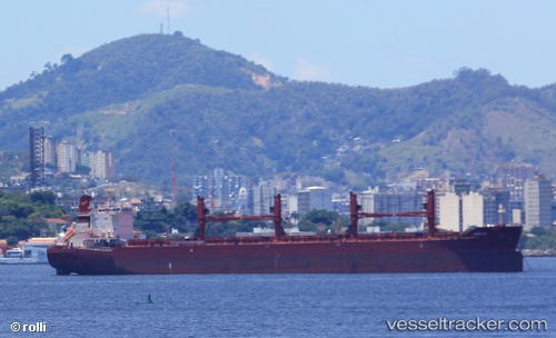
 AEOLIA
Current Status
Where is the vessel?
AEOLIA is currently in 139 nm SW of Les Avirons, based on AIS data received less than 1h ago.
Latest AIS update:
Current position: 22.33080° S, 53.13995° E (139 nm SW of Les Avirons)
Average speed (last 7 days): Loading…
Average speed (last 30 days): Loading…
Vessel profile: AEOLIA is a Cargo with dimensions 199m x 32m.
This page combines live AIS, route history, probable destination signals, nearby traffic, and port activity for practical vessel monitoring.
The current position of vessel AEOLIA is -22.33080 lat / 53.13995 lng. Updated: 2026-05-15 03:33:40 UTCNearest reference points:
- 209 nm E of Manakara
- 194 nm E of Manakara
Currently sailing under the flag of Cyprus ![]()
Details:
Live Vessel AEOLIA Analytics (details, animations, etc.)
Recent AIS points (UTC):
2026-05-14 21:29:10 UTC · -23.05552, 52.40973 · SOG 10.2 kn · COG 45°2026-05-14 22:40:30 UTC · -22.91020, 52.55806 · SOG 10 kn · COG 45°
2026-05-15 00:13:22 UTC · -22.72340, 52.74904 · SOG 9.8 kn · COG 44°
2026-05-15 03:33:40 UTC · -22.33080, 53.13995 · SOG 9.7 kn · COG 42°