 vesseltracker.com
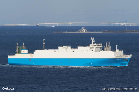
 Harumaru No.3
Current Status
Where is the vessel?
Harumaru No.3 is currently in 24 nm SE of Minachi, based on AIS data received less than 1h ago.
Latest AIS update:
Current position: 33.62464° N, 136.15964° E (24 nm SE of Minachi)
Average speed (last 7 days): Loading…
Average speed (last 30 days): Loading…
Vessel profile: Harumaru No.3 is a Ro Ro Cargo Ship with dimensions 154m x 26m.
This page combines live AIS, route history, probable destination signals, nearby traffic, and port activity for practical vessel monitoring.
The current position of vessel Harumaru No.3 is 33.62464 lat / 136.15964 lng. Updated: 2026-05-16 07:13:59 UTCNearest reference points:
- 23 nm S of Minachi
- 20 nm S of HAMAJIMA
- 18 nm SE of Gobo Wakayama
Currently sailing under the flag of Japan ![]()
Details:
Live Vessel Harumaru No.3 Analytics (details, animations, etc.)
Recent AIS points (UTC):
2026-05-16 04:20:16 UTC · 33.70691, 135.19769 · SOG 18.6 kn · COG 125°2026-05-16 04:59:21 UTC · 33.56032, 135.35709 · SOG 18.3 kn · COG 139°
2026-05-16 05:42:02 UTC · 33.43604, 135.59865 · SOG 22.2 kn · COG 125°
2026-05-16 07:13:59 UTC · 33.62464, 136.15964 · SOG 20.5 kn · COG 52°