 vesseltracker.com
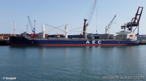
 MANTA OMER MECIT
Current Status
Where is the vessel?
MANTA OMER MECIT is currently in Near Casablanca, based on AIS data received about 1h ago.
Latest AIS update:
Current position: 33.68406° N, 7.62099° W (Near Casablanca)
Average speed (last 7 days): Loading…
Average speed (last 30 days): Loading…
Vessel profile: MANTA OMER MECIT is a Cargo with dimensions m x m.
This page combines live AIS, route history, probable destination signals, nearby traffic, and port activity for practical vessel monitoring.
The current position of vessel MANTA OMER MECIT is 33.68406 lat / -7.62099 lng. Updated: 2026-05-02 22:08:53 UTCNearest reference points:
- Near Mohammedia
- Near Jorf Lasfar
- 54 nm N of El Jadida
Currently sailing under the flag of Marshall Islands ![]()
Details:
Live Vessel MANTA OMER MECIT Analytics (details, animations, etc.)
Recent AIS points (UTC):
2026-05-02 19:02:52 UTC · 33.68294, -7.62184 · SOG 0.2 kn · COG 72°2026-05-02 20:05:57 UTC · 33.68346, -7.62185 · SOG 0.2 kn · COG 86°
2026-05-02 21:56:52 UTC · 33.68414, -7.62141 · SOG 0.1 kn · COG 103°
2026-05-02 22:08:53 UTC · 33.68406, -7.62099 · SOG 0.1 kn · COG 106°