 vesseltracker.com
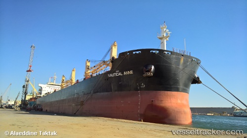
Nautical Anne
Current StatusWhere is the vessel?
Nautical Anne is currently in 131 nm SW of Aquiraz, based on AIS data received less than 1h ago.
Latest AIS update:
Current position: 5.06455° S, 30.20578° W (131 nm SW of Aquiraz)
Average speed (last 7 days): Loading…
Average speed (last 30 days): Loading…
Vessel profile: Nautical Anne is a Bulk Carrier with dimensions 32m x 199m.
This page combines live AIS, route history, probable destination signals, nearby traffic, and port activity for practical vessel monitoring.
The current position of vessel Nautical Anne is -5.06455 lat / -30.20578 lng. Updated: 2026-05-14 17:43:46 UTCDetails:
Live Vessel Nautical Anne Analytics (details, animations, etc.)
Recent AIS points (UTC):
2026-05-14 13:58:51 UTC · -4.69859, -30.63454 · SOG 9 kn · COG 123°2026-05-14 16:26:42 UTC · -4.93592, -30.35078 · SOG 9 kn · COG 124°
2026-05-14 16:26:42 UTC · -4.93592, -30.35078 · SOG 9 kn · COG 124°
2026-05-14 17:43:46 UTC · -5.06455, -30.20578 · SOG 9 kn · COG 126°