 vesseltracker.com
 Mount Hermon
Current Status
Where is the vessel?
Mount Hermon is currently in 74 nm N of Cap Malheureux, based on AIS data received less than 1h ago.
Latest AIS update:
Current position: 18.82167° S, 58.01005° E (74 nm N of Cap Malheureux)
Average speed (last 7 days): Loading…
Average speed (last 30 days): Loading…
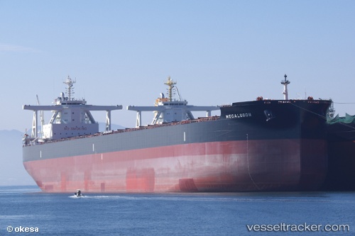
Vessel profile: Mount Hermon is a Bulk Carrier with dimensions 292m x 45m.
This page combines live AIS, route history, probable destination signals, nearby traffic, and port activity for practical vessel monitoring.
The current position of vessel Mount Hermon is -18.82167 lat / 58.01005 lng. Updated: 2026-05-13 22:07:29 UTCNearest reference points:
- Near Port Louis
- 164 nm NW of Pointe aux Canonniers
Currently sailing under the flag of Liberia ![]()
Details:
Live Vessel Mount Hermon Analytics (details, animations, etc.)
Recent AIS points (UTC):
2026-05-13 18:21:55 UTC · -18.35367, 58.81557 · SOG 14.6 kn · COG 239°2026-05-13 19:43:38 UTC · -18.52577, 58.52086 · SOG 14.5 kn · COG 238°
2026-05-13 19:49:29 UTC · -18.53823, 58.49993 · SOG 14.4 kn · COG 238°
2026-05-13 22:07:29 UTC · -18.82167, 58.01005 · SOG 13.5 kn · COG 236°