 vesseltracker.com
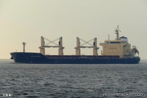
 Merel D
Current Status
Where is the vessel?
Merel D is currently in 18 nm NW of Primavera, based on AIS data received less than 1h ago.
Latest AIS update:
Current position: 52.46560° S, 69.51720° W (18 nm NW of Primavera)
Average speed (last 7 days): Loading…
Average speed (last 30 days): Loading…
Vessel profile: Merel D is a Bulk Carrier with dimensions 179m x 30m.
This page combines live AIS, route history, probable destination signals, nearby traffic, and port activity for practical vessel monitoring.
The current position of vessel Merel D is -52.4656 lat / -69.5172 lng. Updated: 2026-05-18 01:04:25 UTCNearest reference points:
- 13 nm NW of Rio Cullen
- 46 nm SW of Timaukel
Currently sailing under the flag of Malta ![]()
Details:
Live Vessel Merel D Analytics (details, animations, etc.)
Recent AIS points (UTC):
2026-05-17 21:57:45 UTC · -52.45380, -68.71050 · SOG 5.4 kn · COG 291°2026-05-17 22:11:19 UTC · -52.43830, -68.76670 · SOG 12 kn · COG -1°
2026-05-18 00:17:51 UTC · -52.37300, -69.35920 · SOG 8.9 kn · COG 232°
2026-05-18 01:04:25 UTC · -52.46560, -69.51720 · SOG 14.2 kn · COG 229°