 vesseltracker.com
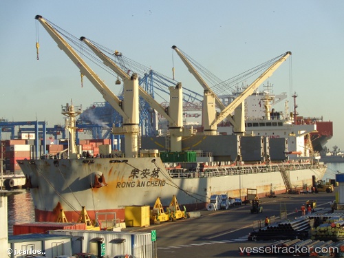
 RONG AN CHENG
Current Status
Where is the vessel?
RONG AN CHENG is currently in 63 nm SW of San Juan, based on AIS data received less than 1h ago.
Latest AIS update:
Current position: 16.29190° S, 75.61721° W (63 nm SW of San Juan)
Average speed (last 7 days): Loading…
Average speed (last 30 days): Loading…
Vessel profile: RONG AN CHENG is a Cargo D with dimensions m x m.
This page combines live AIS, route history, probable destination signals, nearby traffic, and port activity for practical vessel monitoring.
The current position of vessel RONG AN CHENG is -16.29190 lat / -75.61721 lng. Updated: 2026-05-16 11:29:05 UTCNearest reference points:
- 110 nm SW of San Juan
Currently sailing under the flag of China ![]()
Details:
Live Vessel RONG AN CHENG Analytics (details, animations, etc.)
Recent AIS points (UTC):
2026-05-16 08:04:22 UTC · -16.82548, -75.20049 · SOG 11.4 kn · COG 327°2026-05-16 10:14:24 UTC · -16.48711, -75.45301 · SOG 12.2 kn · COG 303°
2026-05-16 10:23:45 UTC · -16.46868, -75.47975 · SOG 12.2 kn · COG 306°
2026-05-16 11:29:05 UTC · -16.29190, -75.61721 · SOG 12.2 kn · COG 333°