 vesseltracker.com
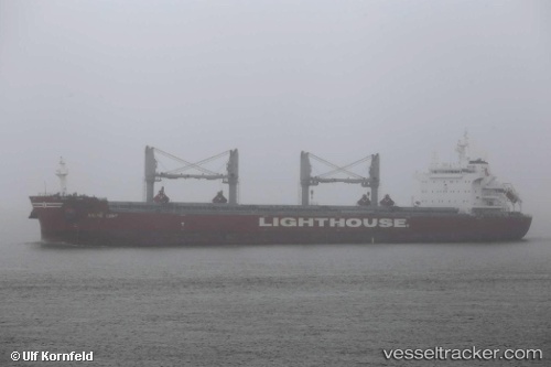
 HOLLINS
Current Status
Where is the vessel?
HOLLINS is currently in 119 nm S of Willow Street, based on AIS data received less than 1h ago.
Latest AIS update:
Current position: 29.09333° N, 75.53833° W (119 nm S of Willow Street)
Average speed (last 7 days): Loading…
Average speed (last 30 days): Loading…
Vessel profile: HOLLINS is a Cargo with dimensions m x m.
This page combines live AIS, route history, probable destination signals, nearby traffic, and port activity for practical vessel monitoring.
The current position of vessel HOLLINS is 29.09333 lat / -75.53833 lng. Updated: 2026-05-15 17:39:01 UTCNearest reference points:
- 113 nm NE of Green Turtle Cay
- 75 nm N of Green Turtle Cay
- Near Green Turtle Cay
Currently sailing under the flag of Singapore ![]()
Details:
Live Vessel HOLLINS Analytics (details, animations, etc.)
Recent AIS points (UTC):
2026-05-15 13:45:02 UTC · 29.88500, -75.74667 · SOG 13 kn · COG -1°2026-05-15 16:06:03 UTC · 29.42333, -75.55167 · SOG 12 kn · COG -1°
2026-05-15 16:11:57 UTC · 29.40310, -75.55180 · SOG 12.6 kn · COG 175°
2026-05-15 17:39:01 UTC · 29.09333, -75.53833 · SOG 13 kn · COG -1°