 vesseltracker.com
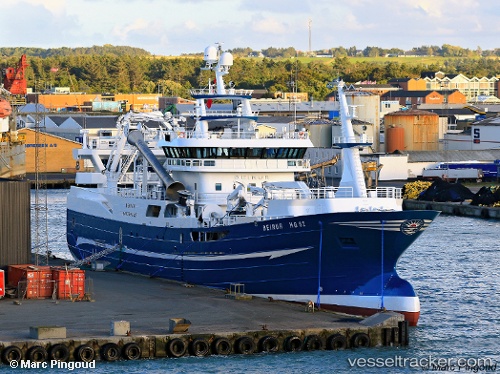
 Beinur
Current Status
Where is the vessel?
Beinur is currently in Near Hirtshals, based on AIS data received about 2h ago.
Latest AIS update:
Current position: 57.59248° N, 9.97286° E (Near Hirtshals)
Average speed (last 7 days): Loading…
Average speed (last 30 days): Loading…
Vessel profile: Beinur is a Fishing Vessel with dimensions 78m x 78m.
This page combines live AIS, route history, probable destination signals, nearby traffic, and port activity for practical vessel monitoring.
The current position of vessel Beinur is 57.59248 lat / 9.97286 lng. Updated: 2026-05-16 10:03:05 UTCNearest reference points:
- Near Hirtshals
- 15 nm N of Hirtshals
- Near SKAGEN
Currently sailing under the flag of Denmark ![]()
Details:
Live Vessel Beinur Analytics (details, animations, etc.)
Recent AIS points (UTC):
2026-05-16 07:29:57 UTC · 57.59245, 9.97273 · SOG 0 kn · COG 132°2026-05-16 07:43:06 UTC · 57.59243, 9.97285 · SOG 0 kn · COG 132°
2026-05-16 09:35:16 UTC · 57.59246, 9.97280 · SOG 0 kn · COG 132°
2026-05-16 10:03:05 UTC · 57.59248, 9.97286 · SOG 0 kn · COG 132°