 vesseltracker.com
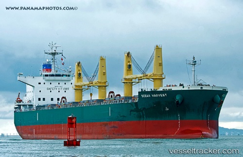
Ocean Harvest
Current StatusWhere is the vessel?
Ocean Harvest is currently in 38 nm SW of Chamela, based on AIS data received less than 1h ago.
Latest AIS update:
Current position: 19.03471° N, 105.48565° W (38 nm SW of Chamela)
Average speed (last 7 days): Loading…
Average speed (last 30 days): Loading…
Vessel profile: Ocean Harvest is a Bulk Carrier with dimensions 32m x 190m.
This page combines live AIS, route history, probable destination signals, nearby traffic, and port activity for practical vessel monitoring.
The current position of vessel Ocean Harvest is 19.03471 lat / -105.48565 lng. Updated: 2026-05-15 10:04:43 UTCNearest reference points:
- Near NUEVO VALLARTA
- 46 nm S of El Ranchito
- 35 nm S of Nayarit
Details:
Live Vessel Ocean Harvest Analytics (details, animations, etc.)
Recent AIS points (UTC):
2026-05-15 05:31:42 UTC · 18.55652, -104.79635 · SOG 10.2 kn · COG 305°2026-05-15 07:11:13 UTC · 18.72938, -105.04230 · SOG 10.7 kn · COG 303°
2026-05-15 07:46:24 UTC · 18.79165, -105.13355 · SOG 10.8 kn · COG 303°
2026-05-15 10:04:43 UTC · 19.03471, -105.48565 · SOG 10.4 kn · COG 308°