 vesseltracker.com
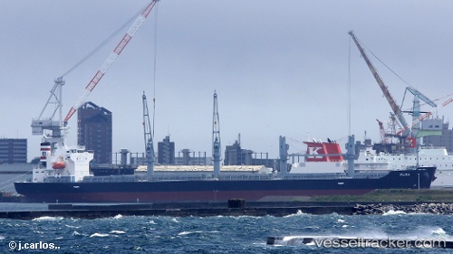
 PUMA
PUMA
Current Status
Where is the vessel?
PUMA is currently in Near Bejaia, based on AIS data received less than 1h ago.
Latest AIS update:
Current position: 36.73833° N, 5.07833° E (Near Bejaia)
Average speed (last 7 days): Loading…
Average speed (last 30 days): Loading…
Vessel profile: PUMA is a Bulk Carrier with dimensions 180m x 30m.
This page combines live AIS, route history, probable destination signals, nearby traffic, and port activity for practical vessel monitoring.
The current position of vessel PUMA is 36.73833 lat / 5.07833 lng. Updated: 2026-04-26 00:08:49 UTCNearest reference points:
- Near Bejaia
- Near Carmona
- Near Zamoranos
Currently sailing under the flag of Cayman Islands ![]()
PUMA built in 2017 year
Deadweight:
34979 tDetails:
Live Vessel PUMA Analytics (details, animations, etc.)
Recent AIS points (UTC):
2026-04-25 18:53:45 UTC · 36.73833, 5.07833 · SOG 0 kn · COG -1°2026-04-25 21:47:43 UTC · 36.73833, 5.07833 · SOG 0 kn · COG -1°
2026-04-25 22:08:48 UTC · 36.73833, 5.07833 · SOG 0 kn · COG -1°
2026-04-26 00:08:49 UTC · 36.73833, 5.07833 · SOG 0 kn · COG -1°