 vesseltracker.com
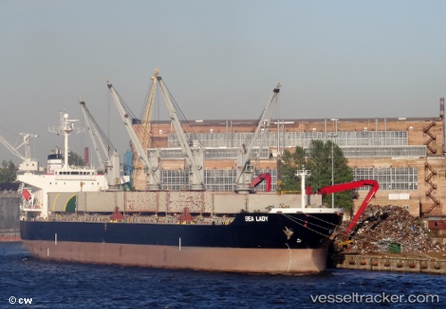
 Sealady
Current Status
Where is the vessel?
Sealady is currently in Near Edgewater Park, based on AIS data received about 1h ago.
Latest AIS update:
Current position: 40.07392° N, 74.90082° W (Near Edgewater Park)
Average speed (last 7 days): Loading…
Average speed (last 30 days): Loading…
Vessel profile: Sealady is a Bulk Carrier with dimensions 200m x 32m.
This page combines live AIS, route history, probable destination signals, nearby traffic, and port activity for practical vessel monitoring.
The current position of vessel Sealady is 40.07392 lat / -74.90082 lng. Updated: 2026-04-02 06:05:53 UTCNearest reference points:
- Near Brooklawn
- Near Trainer
- Near Wilmington
Currently sailing under the flag of Malta ![]()
Details:
Live Vessel Sealady Analytics (details, animations, etc.)
Recent AIS points (UTC):
2026-04-01 23:53:44 UTC · 39.35667, -75.44593 · SOG 12.2 kn · COG 319°2026-04-02 01:31:44 UTC · 39.63719, -75.56534 · SOG 11.1 kn · COG 43°
2026-04-02 03:38:14 UTC · 39.85768, -75.23320 · SOG 9.6 kn · COG 50°
2026-04-02 06:05:53 UTC · 40.07392, -74.90082 · SOG 9 kn · COG 69°