 vesseltracker.com
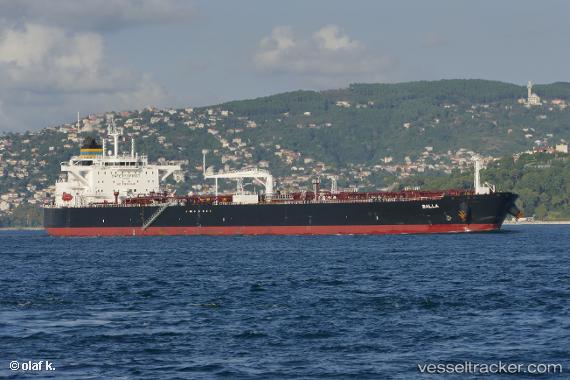
 BALLA
BALLA
Current Status
Where is the vessel?
BALLA is currently in 40 nm N of Assab, based on AIS data received less than 1h ago.
Latest AIS update:
Current position: 13.65252° N, 42.61296° E (40 nm N of Assab)
Average speed (last 7 days): Loading…
Average speed (last 30 days): Loading…
Vessel profile: BALLA is a Crude Oil Tanker with dimensions 250m x 44m.
This page combines live AIS, route history, probable destination signals, nearby traffic, and port activity for practical vessel monitoring.
The current position of vessel BALLA is 13.65252 lat / 42.61296 lng. Updated: 2026-05-13 21:57:29 UTCNearest reference points:
- Near Djibouti
- 81 nm NW of As Salif
Currently sailing under the flag of Liberia ![]()
BALLA built in 2017 year
Deadweight:
113293 tDetails:
Live Vessel BALLA Analytics (details, animations, etc.)
Recent AIS points (UTC):
2026-05-13 18:22:39 UTC · 13.09591, 43.13626 · SOG 14.4 kn · COG 334°2026-05-13 19:37:16 UTC · 13.32736, 42.97865 · SOG 13.1 kn · COG 317°
2026-05-13 19:37:16 UTC · 13.32736, 42.97865 · SOG 13.1 kn · COG 317°
2026-05-13 21:57:29 UTC · 13.65252, 42.61296 · SOG 12.4 kn · COG 338°