 vesseltracker.com
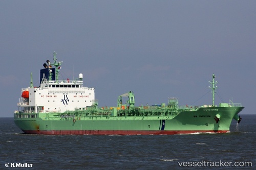
 RADIANT RAY
Current Status
Where is the vessel?
RADIANT RAY is currently in 14 nm N of Rozi, based on AIS data received less than 1h ago.
Latest AIS update:
Current position: 22.79500° N, 70.02333° E (14 nm N of Rozi)
Average speed (last 7 days): Loading…
Average speed (last 30 days): Loading…
Vessel profile: RADIANT RAY is a Chemical/Oil Products Tanker with dimensions 147m x 24m.
This page combines live AIS, route history, probable destination signals, nearby traffic, and port activity for practical vessel monitoring.
The current position of vessel RADIANT RAY is 22.79500 lat / 70.02333 lng. Updated: 2026-05-13 21:30:56 UTCNearest reference points:
- 12 nm N of Rozi
- 15 nm N of Rozi
- Near Rozi
Currently sailing under the flag of Liberia ![]()
RADIANT RAY built in 2018 year
Deadweight:
19974 tDetails:
Live Vessel RADIANT RAY Analytics (details, animations, etc.)
Recent AIS points (UTC):
2026-05-13 18:14:27 UTC · 22.79792, 70.02636 · SOG 0.1 kn · COG 230°2026-05-13 19:08:26 UTC · 22.79766, 70.02663 · SOG 0.1 kn · COG 247°
2026-05-13 19:58:00 UTC · 22.79667, 70.02500 · SOG 0 kn · COG -1°
2026-05-13 21:30:56 UTC · 22.79500, 70.02333 · SOG 0 kn · COG -1°