 vesseltracker.com
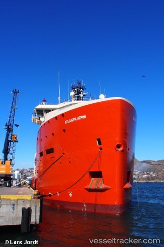
Atlantic Heron
Current StatusWhere is the vessel?
Atlantic Heron is currently in 25 nm SW of White Rose Field, based on AIS data received less than 1h ago.
Latest AIS update:
Current position: 46.54163° N, 48.48419° W (25 nm SW of White Rose Field)
Average speed (last 7 days): Loading…
Average speed (last 30 days): Loading…
Vessel profile: Atlantic Heron is a Offshore Tug Supply Ship with dimensions 22m x 86m.
This page combines live AIS, route history, probable destination signals, nearby traffic, and port activity for practical vessel monitoring.
The current position of vessel Atlantic Heron is 46.54163 lat / -48.48419 lng. Updated: 2026-05-13 16:34:53 UTCNearest reference points:
- 24 nm SW of White Rose Field
- 165 nm S of White Rose Field
Details:
Live Vessel Atlantic Heron Analytics (details, animations, etc.)
Recent AIS points (UTC):
2026-05-13 13:07:12 UTC · 46.54093, -48.50937 · SOG 0.2 kn · COG 209°2026-05-13 13:50:04 UTC · 46.54330, -48.51083 · SOG 4.1 kn · COG 26°
2026-05-13 15:13:01 UTC · 46.56105, -48.47959 · SOG 0.2 kn · COG 196°
2026-05-13 16:34:53 UTC · 46.54163, -48.48419 · SOG 3.5 kn · COG 219°