 vesseltracker.com
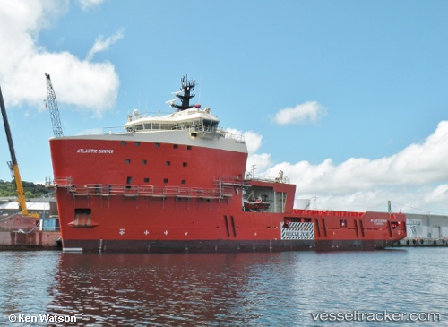
Atlantic Shrike
Current StatusWhere is the vessel?
Atlantic Shrike is currently in 32 nm W of White Rose Field, based on AIS data received less than 1h ago.
Latest AIS update:
Current position: 46.75008° N, 48.78072° W (32 nm W of White Rose Field)
Average speed (last 7 days): Loading…
Average speed (last 30 days): Loading…
Vessel profile: Atlantic Shrike is a Offshore Tug Supply Ship with dimensions 24m x 86m.
This page combines live AIS, route history, probable destination signals, nearby traffic, and port activity for practical vessel monitoring.
The current position of vessel Atlantic Shrike is 46.75008 lat / -48.78072 lng. Updated: 2026-05-15 03:30:33 UTCNearest reference points:
- 24 nm SW of White Rose Field
Details:
Live Vessel Atlantic Shrike Analytics (details, animations, etc.)
Recent AIS points (UTC):
2026-05-14 21:34:46 UTC · 46.75006, -48.78073 · SOG 0.2 kn · COG 48°2026-05-14 22:19:04 UTC · 46.75003, -48.78069 · SOG 0.2 kn · COG 48°
2026-05-14 23:50:24 UTC · 46.75005, -48.78070 · SOG 0.2 kn · COG 48°
2026-05-15 03:30:33 UTC · 46.75008, -48.78072 · SOG 0.3 kn · COG 48°