 vesseltracker.com
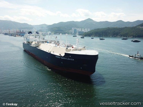
 Rudolf Samoylovich
Current Status
Where is the vessel?
Rudolf Samoylovich is currently in 21 nm W of Den Burg, based on AIS data received less than 1h ago.
Latest AIS update:
Current position: 52.98358° N, 5.35025° W (21 nm W of Den Burg)
Average speed (last 7 days): Loading…
Average speed (last 30 days): Loading…
Vessel profile: Rudolf Samoylovich is a Lng Tanker with dimensions 299m x 299m.
This page combines live AIS, route history, probable destination signals, nearby traffic, and port activity for practical vessel monitoring.
The current position of vessel Rudolf Samoylovich is 52.98358 lat / -5.35025 lng. Updated: 2026-05-15 15:58:52 UTCNearest reference points:
- Near WICKLOW
- Near ARKLOW
- Near Holyhead
Currently sailing under the flag of Bahamas ![]()
Details:
Live Vessel Rudolf Samoylovich Analytics (details, animations, etc.)
Recent AIS points (UTC):
2026-05-15 11:47:30 UTC · 51.81749, -5.75211 · SOG 16.7 kn · COG 29°2026-05-15 13:05:40 UTC · 52.15062, -5.60204 · SOG 16.4 kn · COG 16°
2026-05-15 13:49:58 UTC · 52.34888, -5.51910 · SOG 17 kn · COG 17°
2026-05-15 15:58:52 UTC · 52.98358, -5.35025 · SOG 19.3 kn · COG 8°