 vesseltracker.com
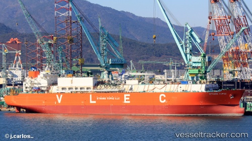
 Ethane Topaz
Current Status
Where is the vessel?
Ethane Topaz is currently in 31 nm W of Cape Of Good Hope, based on AIS data received about 1h ago.
Latest AIS update:
Current position: 34.54941° S, 17.79979° E (31 nm W of Cape Of Good Hope)
Average speed (last 7 days): Loading…
Average speed (last 30 days): Loading…
Vessel profile: Ethane Topaz is a Lpg Tanker with dimensions 228m x 37m.
This page combines live AIS, route history, probable destination signals, nearby traffic, and port activity for practical vessel monitoring.
The current position of vessel Ethane Topaz is -34.54941 lat / 17.79979 lng. Updated: 2026-05-16 15:33:12 UTCNearest reference points:
- 18 nm SW of Cape Of Good Hope
- Near HOUT BAY
- 12 nm W of ROBBEN ISLAND
Currently sailing under the flag of Marshall Is ![]()
Details:
Live Vessel Ethane Topaz Analytics (details, animations, etc.)
Recent AIS points (UTC):
2026-05-16 12:20:43 UTC · -34.79972, 18.73368 · SOG 14.8 kn · COG 280°2026-05-16 14:03:26 UTC · -34.68706, 18.23381 · SOG 15.6 kn · COG 308°
2026-05-16 14:08:53 UTC · -34.67212, 18.21128 · SOG 16 kn · COG 309°
2026-05-16 15:33:12 UTC · -34.54941, 17.79979 · SOG 15.5 kn · COG 280°