 vesseltracker.com
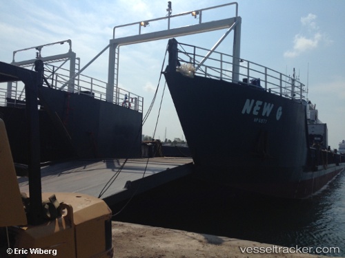
New G
Current StatusWhere is the vessel?
New G is currently in Near Nassau, based on AIS data received about 1h ago.
Latest AIS update:
Current position: 25.07796° N, 77.32567° W (Near Nassau)
Average speed (last 7 days): Loading…
Average speed (last 30 days): Loading…
Vessel profile: New G is a Landing Craft with dimensions 12m x 47m.
This page combines live AIS, route history, probable destination signals, nearby traffic, and port activity for practical vessel monitoring.
The current position of vessel New G is 25.07796 lat / -77.32567 lng. Updated: 2026-04-27 11:39:32 UTCNearest reference points:
- Near Nassau
- Near Lyford Cay
- 11 nm S of Lyford Cay
Details:
Live Vessel New G Analytics (details, animations, etc.)
Recent AIS points (UTC):
2026-04-27 07:52:42 UTC · 25.07796, -77.32565 · SOG 0 kn · COG -1°2026-04-27 10:05:51 UTC · 25.07799, -77.32565 · SOG 0 kn · COG -1°
2026-04-27 10:52:11 UTC · 25.07797, -77.32564 · SOG 0 kn · COG -1°
2026-04-27 11:39:32 UTC · 25.07796, -77.32567 · SOG 0 kn · COG -1°