 vesseltracker.com
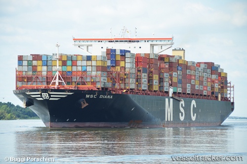
 Msc Diana
Current Status
Where is the vessel?
Msc Diana is currently in 52 nm E of Wenling Longmen Port, based on AIS data received less than 1h ago.
Latest AIS update:
Current position: 28.31167° N, 122.96333° E (52 nm E of Wenling Longmen Port)
Average speed (last 7 days): Loading…
Average speed (last 30 days): Loading…
Vessel profile: Msc Diana is a Container Ship with dimensions 400m x 59m.
This page combines live AIS, route history, probable destination signals, nearby traffic, and port activity for practical vessel monitoring.
The current position of vessel Msc Diana is 28.31167 lat / 122.96333 lng. Updated: 2026-04-29 00:12:32 UTCNearest reference points:
- 55 nm E of Wenling Longmen Port
- 42 nm E of Wenling Longmen Port
- 60 nm NE of Wenling Longmen Port
Currently sailing under the flag of Liberia ![]()
Details:
Live Vessel Msc Diana Analytics (details, animations, etc.)
Recent AIS points (UTC):
2026-04-28 20:13:42 UTC · 27.66271, 122.50850 · SOG 11.1 kn · COG 25°2026-04-28 21:21:28 UTC · 27.85167, 122.63667 · SOG 12 kn · COG -1°
2026-04-28 22:42:29 UTC · 28.08667, 122.80500 · SOG 11 kn · COG -1°
2026-04-29 00:12:32 UTC · 28.31167, 122.96333 · SOG 10 kn · COG -1°