 vesseltracker.com
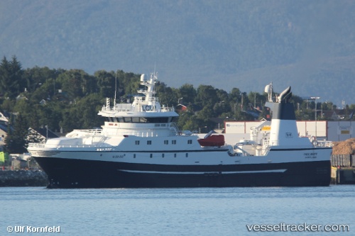
Holmoy
Current StatusWhere is the vessel?
Holmoy is currently in 72 nm E of Hopen, based on AIS data received less than 1h ago.
Latest AIS update:
Current position: 76.55906° N, 30.33742° E (72 nm E of Hopen)
Average speed (last 7 days): Loading…
Average speed (last 30 days): Loading…
Vessel profile: Holmoy is a Fishing Vessel with dimensions 16m x 70m.
This page combines live AIS, route history, probable destination signals, nearby traffic, and port activity for practical vessel monitoring.
The current position of vessel Holmoy is 76.55906 lat / 30.33742 lng. Updated: 2026-05-14 00:00:31 UTCDetails:
Live Vessel Holmoy Analytics (details, animations, etc.)
Recent AIS points (UTC):
2026-05-13 20:07:38 UTC · 76.50489, 30.69140 · SOG 2.3 kn · COG 297°2026-05-13 21:34:30 UTC · 76.52531, 30.46792 · SOG 2.4 kn · COG 299°
2026-05-13 22:21:03 UTC · 76.53965, 30.35134 · SOG 2.3 kn · COG 317°
2026-05-14 00:00:31 UTC · 76.55906, 30.33742 · SOG 3.1 kn · COG 85°