 vesseltracker.com
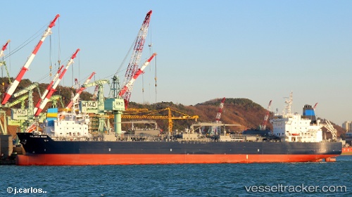
Palanca Miami
Current StatusWhere is the vessel?
Palanca Miami is currently in 26 nm E of Woolgoolga, based on AIS data received about 1h ago.
Latest AIS update:
Current position: 29.97402° S, 153.66917° E (26 nm E of Woolgoolga)
Average speed (last 7 days): Loading…
Average speed (last 30 days): Loading…
Vessel profile: Palanca Miami is a Bitumen Tanker with dimensions 32m x 183m.
This page combines live AIS, route history, probable destination signals, nearby traffic, and port activity for practical vessel monitoring.
The current position of vessel Palanca Miami is -29.97402 lat / 153.66917 lng. Updated: 2026-05-15 14:07:32 UTCNearest reference points:
- Near Gold Coast
- Near Labrador
- Near Biggera Waters
Details:
Live Vessel Palanca Miami Analytics (details, animations, etc.)
Recent AIS points (UTC):
2026-05-15 10:10:48 UTC · -30.70788, 153.50374 · SOG 11.6 kn · COG 17°2026-05-15 11:54:40 UTC · -30.38203, 153.58830 · SOG 11.5 kn · COG 12°
2026-05-15 13:42:09 UTC · -30.05000, 153.65332 · SOG 11 kn · COG 12°
2026-05-15 14:07:32 UTC · -29.97402, 153.66917 · SOG 10.8 kn · COG 13°