 vesseltracker.com
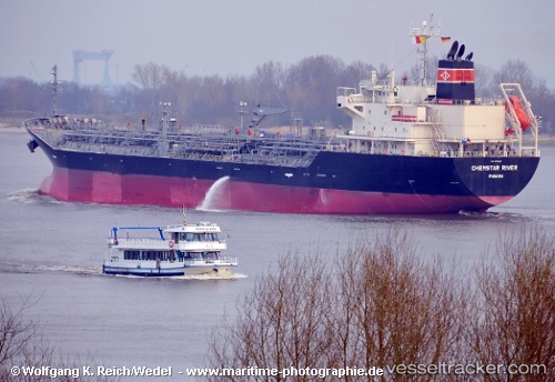
 Chemstar River
Current Status
Where is the vessel?
Chemstar River is currently in 91 nm E of Cidade de Angra dos Reis FPSO, based on AIS data received less than 1h ago.
Latest AIS update:
Current position: 25.19168° S, 41.19070° W (91 nm E of Cidade de Angra dos Reis FPSO)
Average speed (last 7 days): Loading…
Average speed (last 30 days): Loading…
Vessel profile: Chemstar River is a Chemical Oil Products Tanker with dimensions 150m x 150m.
This page combines live AIS, route history, probable destination signals, nearby traffic, and port activity for practical vessel monitoring.
The current position of vessel Chemstar River is -25.19168 lat / -41.19070 lng. Updated: 2026-05-14 04:03:47 UTCNearest reference points:
- 69 nm NE of Cidade de Angra dos Reis FPSO
- 34 nm S of Cidade de Angra dos Reis FPSO
- 47 nm E of Arraial do Cabo
Currently sailing under the flag of Panama ![]()
Details:
Live Vessel Chemstar River Analytics (details, animations, etc.)
Recent AIS points (UTC):
2026-05-14 02:02:25 UTC · -25.48472, -41.55077 · SOG 13 kn · COG 45°2026-05-14 02:49:25 UTC · -25.37018, -41.41139 · SOG 13.3 kn · COG 47°
2026-05-14 03:36:28 UTC · -25.25679, -41.27283 · SOG 13 kn · COG 47°
2026-05-14 04:03:47 UTC · -25.19168, -41.19070 · SOG 13 kn · COG 47°