 vesseltracker.com
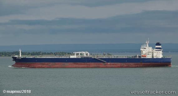
Searanger
Current StatusWhere is the vessel?
Searanger is currently in Near Barcelona, based on AIS data received about 1h ago.
Latest AIS update:
Current position: 10.18411° N, 64.77567° W (Near Barcelona)
Average speed (last 7 days): Loading…
Average speed (last 30 days): Loading…
Vessel profile: Searanger is a Crude Oil Tanker with dimensions 44m x 250m.
This page combines live AIS, route history, probable destination signals, nearby traffic, and port activity for practical vessel monitoring.
The current position of vessel Searanger is 10.18411 lat / -64.77567 lng. Updated: 2026-05-16 17:26:37 UTCNearest reference points:
- Near Puerto Sucre
- 15 nm SW of Punta de Piedras
Details:
Live Vessel Searanger Analytics (details, animations, etc.)
Recent AIS points (UTC):
2026-05-16 13:25:59 UTC · 10.31470, -64.79902 · SOG 8.1 kn · COG 190°2026-05-16 15:29:41 UTC · 10.18525, -64.77358 · SOG 0.4 kn · COG 302°
2026-05-16 16:26:38 UTC · 10.18423, -64.77632 · SOG 0 kn · COG 29°
2026-05-16 17:26:37 UTC · 10.18411, -64.77567 · SOG 0 kn · COG 7°