 vesseltracker.com
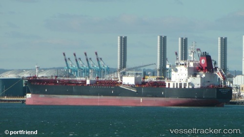
 American Freedom
Current Status
Where is the vessel?
American Freedom is currently in Near White Rock, based on AIS data received less than 1h ago.
Latest AIS update:
Current position: 48.86102° N, 122.75881° W (Near White Rock)
Average speed (last 7 days): Loading…
Average speed (last 30 days): Loading…
Vessel profile: American Freedom is a Chemical Oil Products Tanker with dimensions 183m x 32m.
This page combines live AIS, route history, probable destination signals, nearby traffic, and port activity for practical vessel monitoring.
The current position of vessel American Freedom is 48.86102 lat / -122.75881 lng. Updated: 2026-05-14 15:53:27 UTCNearest reference points:
- Near White Rock
- Near Bellingham
- Near ORCAS
Currently sailing under the flag of USA ![]()
Details:
Live Vessel American Freedom Analytics (details, animations, etc.)
Recent AIS points (UTC):
2026-05-14 12:23:25 UTC · 48.86106, -122.75886 · SOG 0 kn · COG 126°2026-05-14 13:50:33 UTC · 48.86103, -122.75883 · SOG 0 kn · COG 126°
2026-05-14 14:29:32 UTC · 48.86106, -122.75876 · SOG 0 kn · COG 126°
2026-05-14 15:53:27 UTC · 48.86102, -122.75881 · SOG 0 kn · COG 126°