 vesseltracker.com
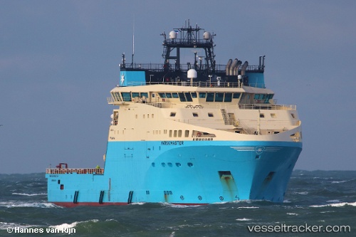
 Maersk Master
Current Status
Where is the vessel?
Maersk Master is currently in 34 nm N of Somersby, based on AIS data received less than 1h ago.
Latest AIS update:
Current position: 53.75142° N, 1.33598° E (34 nm N of Somersby)
Average speed (last 7 days): Loading…
Average speed (last 30 days): Loading…
Vessel profile: Maersk Master is a Offshore Tug Supply Ship with dimensions 95m x 25m.
This page combines live AIS, route history, probable destination signals, nearby traffic, and port activity for practical vessel monitoring.
The current position of vessel Maersk Master is 53.75142 lat / 1.33598 lng. Updated: 2026-05-14 04:12:44 UTCNearest reference points:
- 14 nm E of Withernsea
- 48 nm NE of Somersby
- Near Withernsea
Currently sailing under the flag of Denmark ![]()
Details:
Live Vessel Maersk Master Analytics (details, animations, etc.)
Recent AIS points (UTC):
2026-05-14 00:24:14 UTC · 53.97862, 0.94407 · SOG 8 kn · COG 126°2026-05-14 00:24:14 UTC · 53.97862, 0.94407 · SOG 8 kn · COG 126°
2026-05-14 03:04:52 UTC · 53.75150, 1.33004 · SOG 1.3 kn · COG 316°
2026-05-14 04:12:44 UTC · 53.75142, 1.33598 · SOG 0 kn · COG 335°