 vesseltracker.com
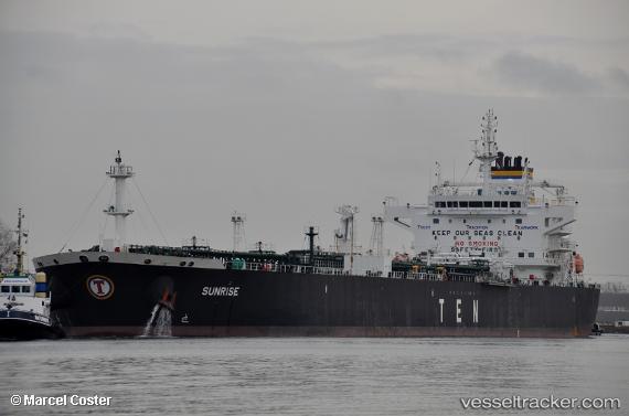
 Sunrise
Current Status
Where is the vessel?
Sunrise is currently in 234 nm E of Dam Mon, based on AIS data received about 2h ago.
Latest AIS update:
Current position: 11.67383° N, 113.25947° E (234 nm E of Dam Mon)
Average speed (last 7 days): Loading…
Average speed (last 30 days): Loading…
Vessel profile: Sunrise is a Crude Oil Tanker with dimensions 228m x 32m.
This page combines live AIS, route history, probable destination signals, nearby traffic, and port activity for practical vessel monitoring.
The current position of vessel Sunrise is 11.67383 lat / 113.25947 lng. Updated: 2026-05-14 09:43:55 UTCNearest reference points:
- 226 nm SE of Tan Cang Qui Nhon
- 211 nm N of Pulau Lang Lang
- 220 nm N of Pulau Lang Lang
Currently sailing under the flag of Liberia ![]()
Details:
Live Vessel Sunrise Analytics (details, animations, etc.)
Recent AIS points (UTC):
2026-05-14 07:05:45 UTC · 12.14344, 113.62431 · SOG 13 kn · COG 216°2026-05-14 07:47:34 UTC · 12.01544, 113.53005 · SOG 13 kn · COG 216°
2026-05-14 09:09:54 UTC · 11.77506, 113.33593 · SOG 13 kn · COG 215°
2026-05-14 09:43:55 UTC · 11.67383, 113.25947 · SOG 13 kn · COG 215°