 vesseltracker.com
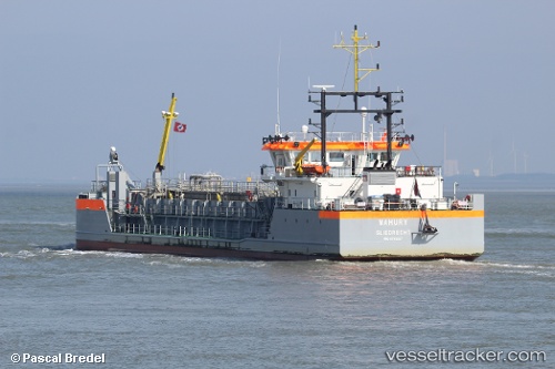
 MAHURY
Current Status
Where is the vessel?
MAHURY is currently in Near Nieuw Amsterdam, based on AIS data received less than 1h ago.
Latest AIS update:
Current position: 5.86467° N, 55.09434° W (Near Nieuw Amsterdam)
Average speed (last 7 days): Loading…
Average speed (last 30 days): Loading…
Vessel profile: MAHURY is a Hopper Dredger with dimensions 13m x 75m.
This page combines live AIS, route history, probable destination signals, nearby traffic, and port activity for practical vessel monitoring.
The current position of vessel MAHURY is 5.86467 lat / -55.09434 lng. Updated: 2026-05-13 22:48:09 UTCNearest reference points:
- Near Paramaribo Zorg en Hoop Airport
- 38 nm NW of Jarikaba
Currently sailing under the flag of Netherlands ![]()
MAHURY built in 2016 year
Deadweight:
1623 tDetails:
Live Vessel MAHURY Analytics (details, animations, etc.)
Recent AIS points (UTC):
2026-05-13 19:38:23 UTC · 5.86891, -55.09522 · SOG 3.4 kn · COG 198°2026-05-13 19:53:03 UTC · 5.86756, -55.09327 · SOG 2.1 kn · COG 270°
2026-05-13 21:49:22 UTC · 5.86539, -55.09354 · SOG 1.6 kn · COG 196°
2026-05-13 22:48:09 UTC · 5.86467, -55.09434 · SOG 2.5 kn · COG 267°