 vesseltracker.com
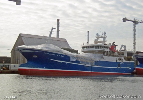
 GERDA MARIE
Current Status
Where is the vessel?
GERDA MARIE is currently in Near HUSOYA, based on AIS data received less than 1h ago.
Latest AIS update:
Current position: 59.33208° N, 5.28991° E (Near HUSOYA)
Average speed (last 7 days): Loading…
Average speed (last 30 days): Loading…
Vessel profile: GERDA MARIE is a Fishing Vessel with dimensions 78m x 16m.
This page combines live AIS, route history, probable destination signals, nearby traffic, and port activity for practical vessel monitoring.
The current position of vessel GERDA MARIE is 59.33208 lat / 5.28991 lng. Updated: 2026-05-14 11:37:56 UTCNearest reference points:
- Near HUSOYA
- Near Storøya
- Near Valevåg
Currently sailing under the flag of Norway ![]()
GERDA MARIE built in 2016 year
Deadweight:
3200 tDetails:
Live Vessel GERDA MARIE Analytics (details, animations, etc.)
Recent AIS points (UTC):
2026-05-14 08:25:25 UTC · 59.33209, 5.28989 · SOG 0 kn · COG 186°2026-05-14 10:14:06 UTC · 59.33208, 5.28989 · SOG 0 kn · COG 186°
2026-05-14 10:42:05 UTC · 59.33208, 5.28989 · SOG 0 kn · COG 186°
2026-05-14 11:37:56 UTC · 59.33208, 5.28991 · SOG 0 kn · COG 186°