 vesseltracker.com
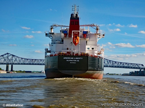
 American Liberty
Current Status
Where is the vessel?
American Liberty is currently in Near Port Everglades, based on AIS data received less than 1h ago.
Latest AIS update:
Current position: 26.09339° N, 80.12110° W (Near Port Everglades)
Average speed (last 7 days): Loading…
Average speed (last 30 days): Loading…
Vessel profile: American Liberty is a Chemical Oil Products Tanker with dimensions 183m x 32m.
This page combines live AIS, route history, probable destination signals, nearby traffic, and port activity for practical vessel monitoring.
The current position of vessel American Liberty is 26.09339 lat / -80.12110 lng. Updated: 2026-05-16 17:48:54 UTCNearest reference points:
- Near Port Everglades
- Near Fort Lauderdale
- Near Dania Beach
Currently sailing under the flag of USA ![]()
Details:
Live Vessel American Liberty Analytics (details, animations, etc.)
Recent AIS points (UTC):
2026-05-16 13:51:49 UTC · 26.09339, -80.12111 · SOG 0 kn · COG 268°2026-05-16 15:21:47 UTC · 26.09334, -80.12111 · SOG 0 kn · COG 268°
2026-05-16 16:15:48 UTC · 26.09338, -80.12115 · SOG 0 kn · COG 269°
2026-05-16 17:48:54 UTC · 26.09339, -80.12110 · SOG 0 kn · COG 269°