 vesseltracker.com
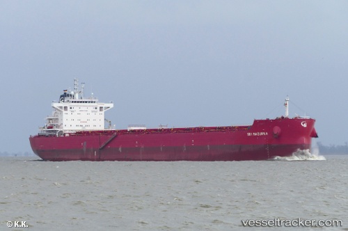
 ANDONIS
Current Status
Where is the vessel?
ANDONIS is currently in Near NEMRUT, based on AIS data received about 2h ago.
Latest AIS update:
Current position: 38.76777° N, 26.93097° E (Near NEMRUT)
Average speed (last 7 days): Loading…
Average speed (last 30 days): Loading…
Vessel profile: ANDONIS is a Bulk Carrier with dimensions 229m x 33m.
This page combines live AIS, route history, probable destination signals, nearby traffic, and port activity for practical vessel monitoring.
The current position of vessel ANDONIS is 38.76777 lat / 26.93097 lng. Updated: 2026-05-15 19:27:05 UTCNearest reference points:
- Near NEMRUT
- Near Nemrut Bay
- Near Aliaga
Currently sailing under the flag of Marshall Islands ![]()
ANDONIS built in 2017 year
Deadweight:
81232 tDetails:
Live Vessel ANDONIS Analytics (details, animations, etc.)
Recent AIS points (UTC):
2026-05-15 17:03:08 UTC · 38.76780, 26.93094 · SOG 0 kn · COG 90°2026-05-15 17:57:05 UTC · 38.76778, 26.93092 · SOG 0 kn · COG 90°
2026-05-15 19:18:06 UTC · 38.76780, 26.93098 · SOG 0 kn · COG 90°
2026-05-15 19:27:05 UTC · 38.76777, 26.93097 · SOG 0 kn · COG 90°