 vesseltracker.com
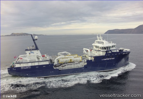
Ronja Challenger
Current StatusWhere is the vessel?
Ronja Challenger is currently in Near Leverburgh, Harris, based on AIS data received less than 1h ago.
Latest AIS update:
Current position: 57.68332° N, 6.99176° W (Near Leverburgh, Harris)
Average speed (last 7 days): Loading…
Average speed (last 30 days): Loading…
Vessel profile: Ronja Challenger is a Fish Carrier with dimensions 12m x 70m.
This page combines live AIS, route history, probable destination signals, nearby traffic, and port activity for practical vessel monitoring.
The current position of vessel Ronja Challenger is 57.68332 lat / -6.99176 lng. Updated: 2026-05-16 01:55:22 UTCNearest reference points:
- Near North Harris
- Near KYLE OF LOCHALSH
- Near Fishnish, Isle of Mull
Details:
Live Vessel Ronja Challenger Analytics (details, animations, etc.)
Recent AIS points (UTC):
2026-05-15 21:27:42 UTC · 57.47164, -6.81185 · SOG 4.9 kn · COG 331°2026-05-15 22:41:31 UTC · 57.55420, -6.91803 · SOG 4.2 kn · COG 336°
2026-05-15 23:43:12 UTC · 57.59321, -6.96113 · SOG 2.6 kn · COG 348°
2026-05-16 01:55:22 UTC · 57.68332, -6.99176 · SOG 3 kn · COG 31°