 vesseltracker.com
 NEW FRONTIER1
Current Status
Where is the vessel?
NEW FRONTIER1 is currently in Near Waterport, based on AIS data received less than 1h ago.
Latest AIS update:
Current position: 36.12986° N, 5.30501° W (Near Waterport)
Average speed (last 7 days): Loading…
Average speed (last 30 days): Loading…
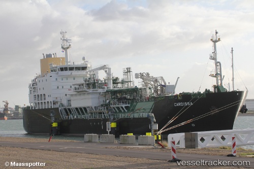
Vessel profile: NEW FRONTIER1 is a Bunkering Tanker (LNG) with dimensions 120m x 19m.
This page combines live AIS, route history, probable destination signals, nearby traffic, and port activity for practical vessel monitoring.
The current position of vessel NEW FRONTIER1 is 36.12986 lat / -5.30501 lng. Updated: 2026-04-26 02:35:51 UTCNearest reference points:
- Near Waterport
- Near La Línea de la Concepción
- Near Palmones
Currently sailing under the flag of Panama ![]()
NEW FRONTIER1 built in 2017 year
Deadweight:
5320 tDetails:
Live Vessel NEW FRONTIER1 Analytics (details, animations, etc.)
Recent AIS points (UTC):
2026-04-25 22:05:18 UTC · 36.13045, -5.30497 · SOG 0.1 kn · COG 94°2026-04-26 00:11:20 UTC · 36.13141, -5.30410 · SOG 0.2 kn · COG 146°
2026-04-26 01:32:19 UTC · 36.13037, -5.30513 · SOG 0.2 kn · COG 89°
2026-04-26 02:35:51 UTC · 36.12986, -5.30501 · SOG 0.2 kn · COG 64°