 vesseltracker.com
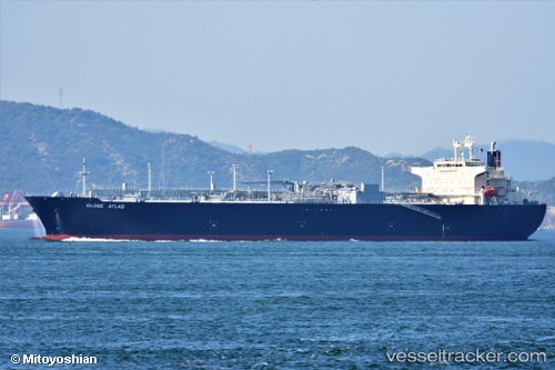
 Globe Atlas
Current Status
Where is the vessel?
Globe Atlas is currently in 298 nm S of Ben Slimane, based on AIS data received less than 1h ago.
Latest AIS update:
Current position: 28.84471° N, 69.53630° W (298 nm S of Ben Slimane)
Average speed (last 7 days): Loading…
Average speed (last 30 days): Loading…
Vessel profile: Globe Atlas is a Lpg Tanker with dimensions 232m x 230m.
This page combines live AIS, route history, probable destination signals, nearby traffic, and port activity for practical vessel monitoring.
The current position of vessel Globe Atlas is 28.84471 lat / -69.53630 lng. Updated: 2026-05-15 06:57:07 UTCNearest reference points:
- 150 nm S of Ben Slimane
Currently sailing under the flag of Panama ![]()
Details:
Live Vessel Globe Atlas Analytics (details, animations, etc.)
Recent AIS points (UTC):
2026-05-15 03:45:59 UTC · 28.56445, -70.29192 · SOG 12.9 kn · COG 69°2026-05-15 04:09:50 UTC · 28.59556, -70.20116 · SOG 13.1 kn · COG 68°
2026-05-15 05:38:47 UTC · 28.72577, -69.84938 · SOG 13.9 kn · COG 69°
2026-05-15 06:57:07 UTC · 28.84471, -69.53630 · SOG 13.5 kn · COG 70°