 vesseltracker.com
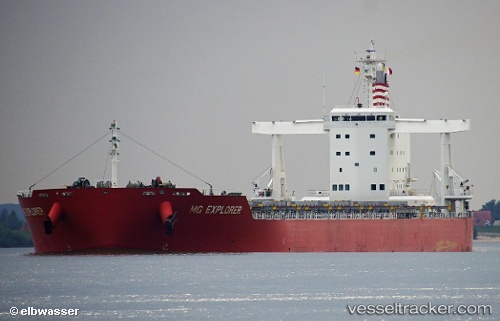
Mg Explorer
Current StatusWhere is the vessel?
Mg Explorer is currently in 106 nm W of Kings Bromley, based on AIS data received about 2h ago.
Latest AIS update:
Current position: 52.86720° N, 151.91142° W (106 nm W of Kings Bromley)
Average speed (last 7 days): Loading…
Average speed (last 30 days): Loading…
Vessel profile: Mg Explorer is a Bulk Carrier with dimensions 34m x 229m.
This page combines live AIS, route history, probable destination signals, nearby traffic, and port activity for practical vessel monitoring.
The current position of vessel Mg Explorer is 52.86720 lat / -151.91142 lng. Updated: 2026-05-14 07:49:28 UTCDetails:
Live Vessel Mg Explorer Analytics (details, animations, etc.)
Recent AIS points (UTC):
2026-05-14 04:48:12 UTC · 53.00333, -152.95441 · SOG 12.7 kn · COG 102°2026-05-14 06:21:40 UTC · 52.93831, -152.42509 · SOG 12.9 kn · COG 103°
2026-05-14 07:11:48 UTC · 52.89667, -152.12500 · SOG 12 kn · COG -1°
2026-05-14 07:49:28 UTC · 52.86720, -151.91142 · SOG 12.7 kn · COG 104°