 vesseltracker.com
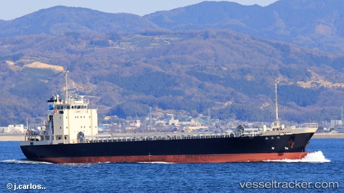
 Seisyu Maru
Current Status
Where is the vessel?
Seisyu Maru is currently in 19 nm W of IKATA, based on AIS data received less than 1h ago.
Latest AIS update:
Current position: 33.54500° N, 131.98334° E (19 nm W of IKATA)
Average speed (last 7 days): Loading…
Average speed (last 30 days): Loading…
Vessel profile: Seisyu Maru is a General Cargo Ship with dimensions 84m x 13m.
This page combines live AIS, route history, probable destination signals, nearby traffic, and port activity for practical vessel monitoring.
The current position of vessel Seisyu Maru is 33.54500 lat / 131.98334 lng. Updated: 2026-05-01 22:10:30 UTCNearest reference points:
- 18 nm SE of HIKARI
- 13 nm S of HIKARI
- 14 nm SE of HIKARI
Currently sailing under the flag of Japan ![]()
Details:
Live Vessel Seisyu Maru Analytics (details, animations, etc.)
Recent AIS points (UTC):
2026-05-01 19:33:43 UTC · 33.86354, 132.56863 · SOG 14 kn · COG 223°2026-05-01 19:59:21 UTC · 33.80130, 132.47667 · SOG 14 kn · COG 236°
2026-05-01 22:02:15 UTC · 33.56265, 132.01324 · SOG 13 kn · COG 233°
2026-05-01 22:10:30 UTC · 33.54500, 131.98334 · SOG 13 kn · COG -1°