 vesseltracker.com
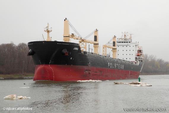
 JAMNO
JAMNO
Current Status
Where is the vessel?
JAMNO is currently in 82 nm NE of Seica, based on AIS data received about 1h ago.
Latest AIS update:
Current position: 41.00833° N, 48.72833° W (82 nm NE of Seica)
Average speed (last 7 days): Loading…
Average speed (last 30 days): Loading…
Vessel profile: JAMNO is a General Cargo Ship with dimensions m x m.
This page combines live AIS, route history, probable destination signals, nearby traffic, and port activity for practical vessel monitoring.
The current position of vessel JAMNO is 41.00833 lat / -48.72833 lng. Updated: 2026-05-13 19:56:34 UTCNearest reference points:
- 76 nm SW of Seica
Currently sailing under the flag of Bahamas ![]()
JAMNO built in 2018 year
Deadweight:
36609 tDetails:
Live Vessel JAMNO Analytics (details, animations, etc.)
Recent AIS points (UTC):
2026-05-13 16:32:33 UTC · 40.98667, -49.62667 · SOG 12 kn · COG -1°2026-05-13 17:59:33 UTC · 40.99833, -49.23500 · SOG 11 kn · COG -1°
2026-05-13 19:12:18 UTC · 41.00385, -48.91830 · SOG 11.4 kn · COG 92°
2026-05-13 19:56:34 UTC · 41.00833, -48.72833 · SOG 11 kn · COG -1°