 vesseltracker.com
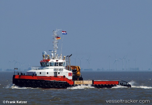
 Noordstroom
Current Status
Where is the vessel?
Noordstroom is currently in Near Rockanje, based on AIS data received less than 1h ago.
Latest AIS update:
Current position: 51.91152° N, 3.97088° E (Near Rockanje)
Average speed (last 7 days): Loading…
Average speed (last 30 days): Loading…
Vessel profile: Noordstroom is a Tug with dimensions 35m x 12m.
This page combines live AIS, route history, probable destination signals, nearby traffic, and port activity for practical vessel monitoring.
The current position of vessel Noordstroom is 51.91152 lat / 3.97088 lng. Updated: 2026-05-15 04:41:06 UTCNearest reference points:
- Near MAASVLAKTE - ROTTERDAM
- Near Rockanje
- Near Haarlemmermeer
Currently sailing under the flag of Netherlands ![]()
Details:
Live Vessel Noordstroom Analytics (details, animations, etc.)
Recent AIS points (UTC):
2026-05-14 23:56:12 UTC · 51.91248, 3.97066 · SOG 0 kn · COG 23°2026-05-15 01:14:11 UTC · 51.91184, 3.97156 · SOG 0.1 kn · COG 98°
2026-05-15 03:59:07 UTC · 51.91167, 3.97141 · SOG 0 kn · COG 132°
2026-05-15 04:41:06 UTC · 51.91152, 3.97088 · SOG 0 kn · COG 170°