 vesseltracker.com
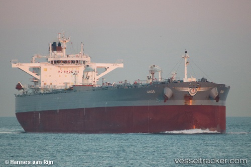
 CHIOS
CHIOS
Current Status
Where is the vessel?
CHIOS is currently in 51 nm S of Avalon, based on AIS data received about 2h ago.
Latest AIS update:
Current position: 32.49137° N, 118.44382° W (51 nm S of Avalon)
Average speed (last 7 days): Loading…
Average speed (last 30 days): Loading…
Vessel profile: CHIOS is a Crude Oil Tanker with dimensions 48m x 273m.
This page combines live AIS, route history, probable destination signals, nearby traffic, and port activity for practical vessel monitoring.
The current position of vessel CHIOS is 32.49137 lat / -118.44382 lng. Updated: 2026-04-27 07:51:31 UTCNearest reference points:
- 35 nm W of Del Mar, San Diego
- 17 nm S of Avalon
- 12 nm SW of Avalon
Currently sailing under the flag of Greece ![]()
CHIOS built in 2016 year
Deadweight:
158902 tDetails:
Live Vessel CHIOS Analytics (details, animations, etc.)
Recent AIS points (UTC):
2026-04-27 04:11:38 UTC · 32.49486, -118.45579 · SOG 0.5 kn · COG 106°2026-04-27 04:21:05 UTC · 32.49445, -118.45515 · SOG 0.6 kn · COG 106°
2026-04-27 07:51:31 UTC · 32.49137, -118.44382 · SOG 0.6 kn · COG 120°
2026-04-27 07:51:31 UTC · 32.49137, -118.44382 · SOG 0.6 kn · COG 120°