 vesseltracker.com
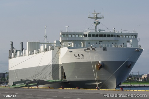
Hokuren Maru No.2
Current StatusWhere is the vessel?
Hokuren Maru No.2 is currently in Near Kushiro, based on AIS data received less than 1h ago.
Latest AIS update:
Current position: 42.88557° N, 144.20827° E (Near Kushiro)
Average speed (last 7 days): Loading…
Average speed (last 30 days): Loading…
Vessel profile: Hokuren Maru No.2 is a Ro Ro Cargo Ship with dimensions 27m x 173m.
This page combines live AIS, route history, probable destination signals, nearby traffic, and port activity for practical vessel monitoring.
The current position of vessel Hokuren Maru No.2 is 42.88557 lat / 144.20827 lng. Updated: 2026-05-17 04:21:14 UTCNearest reference points:
- Near Kushiro
- Near NISHI
- 11 nm NE of Tomari
Details:
Live Vessel Hokuren Maru No.2 Analytics (details, animations, etc.)
Recent AIS points (UTC):
2026-05-17 01:15:02 UTC · 41.90452, 143.50261 · SOG 21.3 kn · COG 28°2026-05-17 02:07:26 UTC · 42.18152, 143.68655 · SOG 20.9 kn · COG 28°
2026-05-17 03:51:32 UTC · 42.73507, 144.09425 · SOG 20.8 kn · COG 30°
2026-05-17 04:21:14 UTC · 42.88557, 144.20827 · SOG 20.1 kn · COG 31°