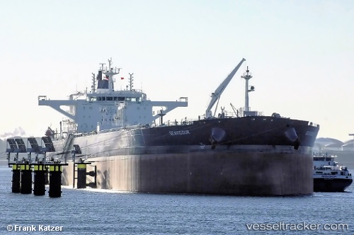
Seavigour
Current StatusWhere is the vessel?
Seavigour is currently in 347 nm E of Diego Garcia, based on AIS data received about 15h ago.
Latest AIS update:
Current position: 6.09007° S, 78.14772° E (347 nm E of Diego Garcia)
Average speed (last 7 days): Loading…
Average speed (last 30 days): Loading…
Vessel profile: Seavigour is a Crude Oil Tanker with dimensions 48m x 274m.
This page combines live AIS, route history, probable destination signals, nearby traffic, and port activity for practical vessel monitoring.
The current position of vessel Seavigour is -6.09007 lat / 78.14772 lng. Updated: 2026-05-24 03:56:55 UTCNearest reference points:
- Open sea, approx. 400 nm off the nearest listed port
- Open sea, approx. 401 nm off the nearest listed port
- Open sea, approx. 402 nm off the nearest listed port
Details:
Live Vessel Seavigour Analytics (details, animations, etc.)
Recent AIS points (UTC):
2026-05-24 00:58:29 UTC · -5.70182, 78.66966 · SOG 13.4 kn · COG 235°2026-05-24 01:39:51 UTC · -5.77239, 78.57467 · SOG 13.8 kn · COG 237°
2026-05-24 03:56:55 UTC · -6.09007, 78.14772 · SOG 13.1 kn · COG 235°
2026-05-24 03:56:55 UTC · -6.09007, 78.14772 · SOG 13.1 kn · COG 235°