 vesseltracker.com
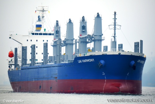
Uni Harmony
Current StatusWhere is the vessel?
Uni Harmony is currently in 29 nm SW of GENERAL SANTOS, based on AIS data received about 12h ago.
Latest AIS update:
Current position: 5.83385° N, 124.74821° E (29 nm SW of GENERAL SANTOS)
Average speed (last 7 days): Loading…
Average speed (last 30 days): Loading…
Vessel profile: Uni Harmony is a Bulk Carrier with dimensions 30m x 180m.
This page combines live AIS, route history, probable destination signals, nearby traffic, and port activity for practical vessel monitoring.
The current position of vessel Uni Harmony is 5.83385 lat / 124.74821 lng. Updated: 2026-05-16 04:04:11 UTCNearest reference points:
- Near DICT / SVT
- 48 nm N of Melonguanne
- 14 nm SE of Zamboanga
Details:
Live Vessel Uni Harmony Analytics (details, animations, etc.)
Recent AIS points (UTC):
2026-05-16 04:04:11 UTC · 5.83385, 124.74821 · SOG 12.7 kn · COG 282°2026-05-16 04:04:11 UTC · 5.83385, 124.74821 · SOG 12.7 kn · COG 282°
2026-05-16 04:04:11 UTC · 5.83385, 124.74821 · SOG 12.7 kn · COG 282°
2026-05-16 04:04:11 UTC · 5.83385, 124.74821 · SOG 12.7 kn · COG 282°