 vesseltracker.com
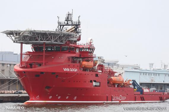
Van Gogh
Current StatusWhere is the vessel?
Van Gogh is currently in Near Kampung Tanjung Langsat, based on AIS data received less than 1h ago.
Latest AIS update:
Current position: 1.45659° N, 104.01179° E (Near Kampung Tanjung Langsat)
Average speed (last 7 days): Loading…
Average speed (last 30 days): Loading…
Vessel profile: Van Gogh is a [service_ship.crane_barge] with dimensions 23m x 112m.
This page combines live AIS, route history, probable destination signals, nearby traffic, and port activity for practical vessel monitoring.
The current position of vessel Van Gogh is 1.45659 lat / 104.01179 lng. Updated: 2026-05-14 10:43:55 UTCNearest reference points:
- Near CHANGI
- Near Johor
- Near PASIR GUDANG
Details:
Live Vessel Van Gogh Analytics (details, animations, etc.)
Recent AIS points (UTC):
2026-05-14 07:44:02 UTC · 1.45658, 104.01177 · SOG 0 kn · COG 191°2026-05-14 07:56:02 UTC · 1.45659, 104.01177 · SOG 0 kn · COG 191°
2026-05-14 09:20:03 UTC · 1.45659, 104.01177 · SOG 0 kn · COG 191°
2026-05-14 10:43:55 UTC · 1.45659, 104.01179 · SOG 0 kn · COG 191°