 vesseltracker.com
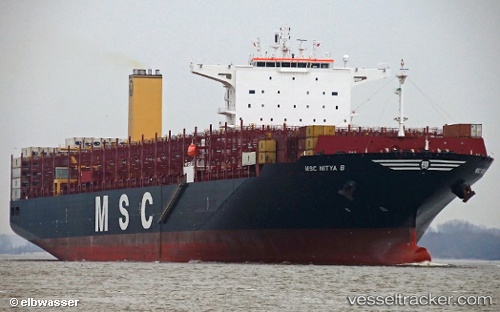
 Msc Nitya B
Current Status
Where is the vessel?
Msc Nitya B is currently in Near Balboa, based on AIS data received about 1h ago.
Latest AIS update:
Current position: 8.95667° N, 79.57333° W (Near Balboa)
Average speed (last 7 days): Loading…
Average speed (last 30 days): Loading…
Vessel profile: Msc Nitya B is a Container Ship with dimensions 330m x 48m.
This page combines live AIS, route history, probable destination signals, nearby traffic, and port activity for practical vessel monitoring.
The current position of vessel Msc Nitya B is 8.95667 lat / -79.57333 lng. Updated: 2026-05-15 11:26:17 UTCNearest reference points:
- Near Cocoli
- Near El Chorrillo
- Near Panama
Currently sailing under the flag of Portugal ![]()
Details:
Live Vessel Msc Nitya B Analytics (details, animations, etc.)
Recent AIS points (UTC):
2026-05-15 08:07:08 UTC · 8.95725, -79.57474 · SOG 0 kn · COG 331°2026-05-15 09:46:15 UTC · 8.95731, -79.57471 · SOG 0 kn · COG 331°
2026-05-15 10:55:07 UTC · 8.95728, -79.57473 · SOG 0 kn · COG 332°
2026-05-15 11:26:17 UTC · 8.95667, -79.57333 · SOG 0 kn · COG -1°