 vesseltracker.com
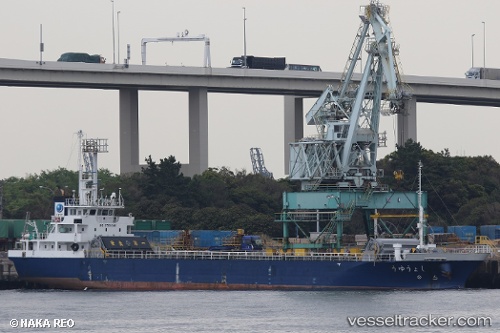
Shoyu
Current StatusWhere is the vessel?
Shoyu is currently in Near FUKUYAMA, based on AIS data received less than 1h ago.
Latest AIS update:
Current position: 34.46812° N, 133.44582° E (Near FUKUYAMA)
Average speed (last 7 days): Loading…
Average speed (last 30 days): Loading…
Vessel profile: Shoyu is a General Cargo Ship with dimensions 12m x 75m.
This page combines live AIS, route history, probable destination signals, nearby traffic, and port activity for practical vessel monitoring.
The current position of vessel Shoyu is 34.46812 lat / 133.44582 lng. Updated: 2026-05-14 04:25:17 UTCNearest reference points:
- Near FUKUYAMA
- Near MIZUSHIMA
- Near Kurashiki
Details:
Live Vessel Shoyu Analytics (details, animations, etc.)
Recent AIS points (UTC):
2026-05-14 01:40:17 UTC · 34.46812, 133.44588 · SOG 0 kn · COG -1°2026-05-14 01:46:18 UTC · 34.46812, 133.44585 · SOG 0 kn · COG 2°
2026-05-14 03:34:22 UTC · 34.46812, 133.44589 · SOG 0 kn · COG 1°
2026-05-14 04:25:17 UTC · 34.46812, 133.44582 · SOG 0 kn · COG 2°