 vesseltracker.com
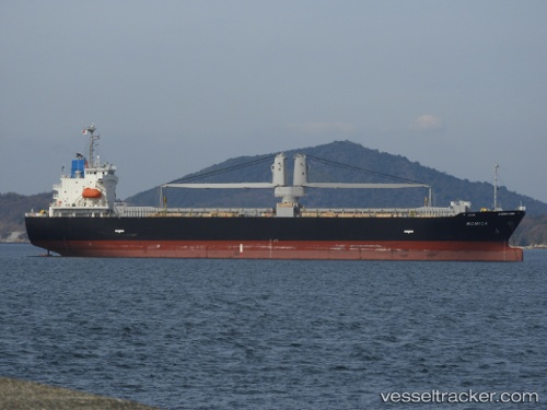
 MELIA
MELIA
Current Status
Where is the vessel?
MELIA is currently in 26 nm S of OMAEZAKI, based on AIS data received about 1h ago.
Latest AIS update:
Current position: 34.22081° N, 138.38849° E (26 nm S of OMAEZAKI)
Average speed (last 7 days): Loading…
Average speed (last 30 days): Loading…
Vessel profile: MELIA is a Cargo with dimensions m x m.
This page combines live AIS, route history, probable destination signals, nearby traffic, and port activity for practical vessel monitoring.
The current position of vessel MELIA is 34.22081 lat / 138.38849 lng. Updated: 2026-05-16 07:43:06 UTCNearest reference points:
- Near Iruma
- 17 nm SW of OMAEZAKI
- Near OMAEZAKI
Currently sailing under the flag of Philippines ![]()
Details:
Live Vessel MELIA Analytics (details, animations, etc.)
Recent AIS points (UTC):
2026-05-16 04:03:38 UTC · 34.20855, 138.44118 · SOG 1 kn · COG 185°2026-05-16 05:32:08 UTC · 34.21557, 138.41582 · SOG 0.8 kn · COG 190°
2026-05-16 06:40:07 UTC · 34.21815, 138.40083 · SOG 0.8 kn · COG 211°
2026-05-16 07:43:06 UTC · 34.22081, 138.38849 · SOG 0.6 kn · COG 217°